
LAND SURVEYING SERVICES

Accurate Land Surveying Services Throughout New York State
The National Society of Professional Surveyors
states that surveying is the science and art of making all essential measurements to determine the relative position of points or physical and cultural details above, on, or beneath the surface of the Earth, and to depict them in a usable form, or to establish the position of points or details. Corner Post Land Surveying, PLLC
can prepare the legal descriptions and maps for subdividing property, implementing boundary line adjustments, replace lost or obliterated property corners, set boundary markers, retrace boundaries for fences and other purposes. Call us today for more information at 518-692-2435.


- Prepare and maintain sketches, maps, reports, and legal descriptions of surveys in order to describe and certify work performed.
- Verify the accuracy of survey data, including measurements and calculations conducted at survey sites.
- Direct or conduct surveys in order to establish the legal boundaries of properties based on deeds and real estate titles.
- Record the results of surveys, including the shape, contour, location, elevation, and dimensions of land and land features.
- Calculate heights, depths, relative positions, property lines, and other terrain features.
- Collect or prepare all data, charts, plots, maps, records, and documents related to surveys.
Corner Post Land Surveying, PLLC offers a wide variety of surveying services including:
- Small and large boundary surveys
- Mortgage, Final and Foundation surveys
- Commercial surveying
- ALTA/NSPS surveys
- As-built surveys
- Right of way surveys
- Easement surveys
- Utility surveying
- Route surveying
- Subdivision planning and design
- Minor and Major subdivisions
- Lot Line Adjustments
- Property Line Maintenance
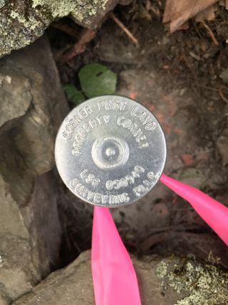
- Property Corner and Line marking
- Tree Identification and Location surveys
- Land Use surveying and mapping
- GPS Surveys
- Deed research and plotting
- Legal descriptions for Right of Ways, Easements, and Parcels
- Topographic surveying and mapping
- Scanning Surveys
- Building and Structural Elevation surveys (Exterior and Interior)
- Aerial Photogrammetric Control survey
- Site planning and mapping
- Parcel mapping
- Mapping and Drafting services
- Wetland Location and Mapping
- FEMA Elevation Certificates
- FEMA LOMA, CLOMA, LOMR-F, and CLOMR-F Elevation forms
- Construction Staking and Layout
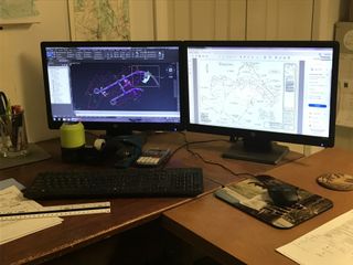
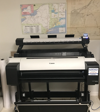
Using the Most Updated Technology Including:
- Autodesk Civil 3D
- Trimble Business Center
- Canon Wide Format Plotter
- MFP Wide Format Scanner
- Two fully functional robotic total stations (one equipped with scanning unit)
- Trimble R10 GPS unit
BROWSE OUR WEBSITE
CONTACT INFORMATION
We Service The Following Areas:
Albany, Amsterdam, Catskill, Clifton Park, Colonie, Guilderland, Cohoes, Watervliet, Glens Falls, South Glens Falls, Hudson, Hudson Falls, Malta, Plattsburgh, Poughkeepsie, Queensbury, Rensselaer, Rome, Saranac Lake, Saratoga Springs, Schenectady, Syracuse, Troy and in all areas of Albany County, Columbia County, Essex County, Franklin County, Fulton County, Greene County, Hamilton County, Herkimer County, Montgomery County, Rensselaer County, Saratoga County, Schenectady County, Schoharie County, Warren County and Washington County